Irish Shore Fishing
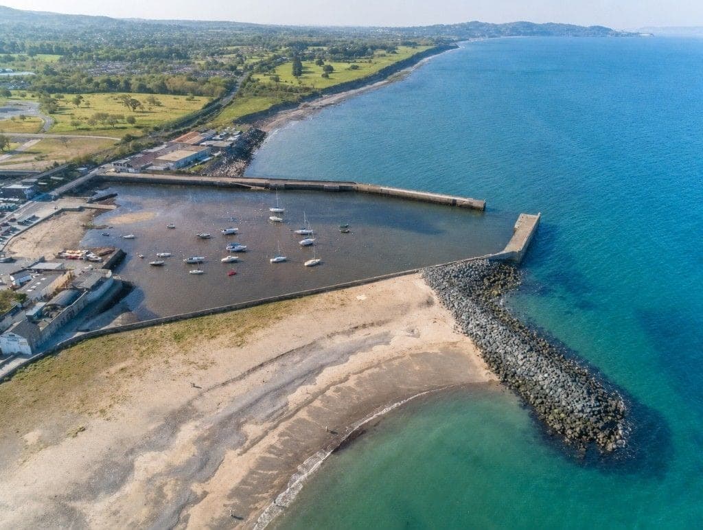
Illustration for Jack's Hole.

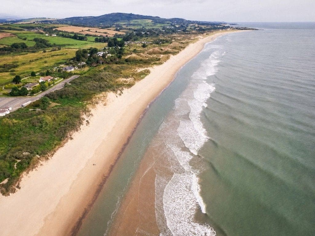
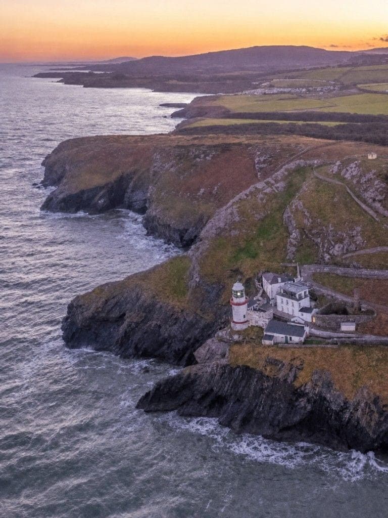
Wicklow coast

Jack's Hole

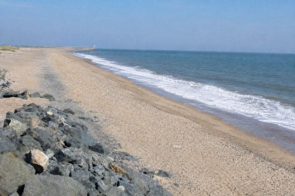
Rock and sand, Wicklow town. The usual tide here: the push of the flood into high water.

  • Bass
  • Wrasse
  • Pollack
  • Flounder
  • Whiting

Tomorrow 06:01 – 11:38

Too rough

The push of the flood into high water, light from 07:10. Yellow Small Craft warning. Yellow Gale warning covers some or all of this window.

Wind
S 48 km/hGusts 60 km/h
Waves
1.6 mModerate surf, over the window
Tide
High 11:10Mon, 2.7 m

The coast’s call for these hours: effort from the wind, gusts and rain read at Greystones. Not a call on this mark, and whether the fish are there is not called.

Illustration, made with Adobe Firefly.

Next 24 hours at Wicklow town

Tide, light, wind and sea conditions for your session. The wind is read at Greystones; which way this mark faces is not verified yet, so it is not judged against its shore.

View detailed forecast
Sunrise 07:10 MonSunset 17:05 MonHigh 22:502.7 mHigh 11:10 Mon2.7 mNow
The next 24 hours: the next tide window 06:01 Mon to 11:38 Mon, Too rough; high water 22:50, 2.7 m; low water 04:35 Mon, 0.3 m; high water 11:10 Mon, 2.7 m; low water 17:00 Mon, 0.4 m; sunrise 07:10, sunset 17:05.
Wind, gusts and rain by the hour, read at Greystones
HourWind km/hGusts km/hRain mm
22:0021 from SSWnot given0
23:0021 from SW260
00:0021 from SW270
01:0017 from SSW250
02:0017 from SSW220
03:0019 from S230
04:0028 from S280.4
05:0040 from S401.1
06:0045 from S491.3
07:0047 from S572.0
08:0048 from S601.2
09:0041 from SSW600.3
10:0035 from SSW550
11:0037 from SSW500
12:0041 from SSW530
13:0045 from SSW590.1
14:0045 from SSW640
15:0046 from SSW650
16:0047 from SSW660.1
17:0048 from SSW690.2
18:0048 from SSW730.2
19:0052 from S760.5
20:0055 from S801.1
21:0057 from S821.6

Wind and rain at Greystones: MET Norway. Gusts: Met Éireann. Tide: Marine Institute, predicted. Light from the sun’s position; the moon, full moon, about 100% lit, calculated.

The coast north to south

Check the latest wind at each stretch of the coast.

View all areas

Illustrations, made with Adobe Firefly.

Safety here

Rock and sand today: Caution. A Met Éireann yellow warning covers this coast for the time judged. Part of this ground is rock, so it is judged as rock. Waves 0.4 m. A rock mark is never clear until two wave models agree below the threshold: caution.

Not verified · no fact on this mark has a dated check yet

Hazards: not checked on site. Assume the worst footing and tide cut-off, and read the hazard notes below as a starting point.

Fishing permission: not checked. No bye-law, harbour rule or landowner permission has been read for this mark.

Serious hazard · record reviewed August 2026

  • Never fish alone
  • Swell wash

Slippery rock ledge with south-easterly swell wash. Non-slip footwear is essential. Check sea state before descending, budget for snag losses on the rock side, and never fish this mark alone.

Met Éireann warnings

Yellow Small Craft warning until 23:59 TueIssued in 2 parts

Small Craft warning for all coasts of Ireland

Level
yellow
Event
Small Craft
Severity
Moderate
Certainty
Likely
Onset
Expires
Issued
Areas
  • EI811 (Wicklow Head to Carnsore Point)
  • EI822
  • EI817
  • EI806
  • EI812
  • EI819
  • EI820
  • EI821
  • EI807
  • EI808
  • EI810 (Howth Head to Wicklow Head)
  • EI805
  • EI813
  • EI814
  • EI815
  • EI816
  • EI818
  • EI809 (Carlingford Lough to Howth Head)

Storm Boelo: Westerly winds will reach force 6 or higher at times.

Small Craft warning for all coasts of Ireland

Level
yellow
Event
Small Craft
Severity
Moderate
Certainty
Likely
Not yet in force. Onset
Expires
Issued
Areas
  • EI811 (Wicklow Head to Carnsore Point)
  • EI822
  • EI817
  • EI806
  • EI812
  • EI819
  • EI820
  • EI821
  • EI807
  • EI808
  • EI810 (Howth Head to Wicklow Head)
  • EI805
  • EI813
  • EI814
  • EI815
  • EI816
  • EI818
  • EI809 (Carlingford Lough to Howth Head)

Southerly winds will reach force 6 or higher, veering westerly on Tuesday.

Yellow Gale warning from 09:00 Mon to 02:00 Tue

Status Yellow - Marine Gale warning for all coasts of Ireland and on the Irish Sea

Level
yellow
Event
Yellow Gale
Severity
Moderate
Certainty
Likely
Not yet in force. Onset
Expires
Issued
Areas
  • EI811 (Wicklow Head to Carnsore Point)
  • EI822
  • EI817
  • EI806
  • EI812
  • EI819
  • EI820
  • EI821
  • EI807
  • EI808
  • EI810 (Howth Head to Wicklow Head)
  • EI805
  • EI813
  • EI814
  • EI815
  • EI816
  • EI818
  • EI824
  • EI809 (Carlingford Lough to Howth Head)
  • EI823
  • EI825

Southerly winds, veering westerly on Tuesday, will reach gale force 8 or strong gale force 9.

Yellow Wind warning from 17:00 Mon to 23:59 Mon

Status Yellow - Wind warning for Carlow, Clare, Cork, Donegal, Galway, Kerry, Kilkenny, Mayo, Waterford, Wexford, Wicklow

Level
yellow
Event
Yellow Wind
Severity
Moderate
Certainty
Likely
Not yet in force. Onset
Expires
Issued
Areas
  • EI01
  • EI10
  • EI20
  • EI03
  • EI11
  • EI30
  • EI06
  • EI04
  • EI13
  • EI31 (Wicklow)
  • EI27

Very strong and gusty south to southwest winds.

Be aware of potential impacts:

  • Debris, loose objects displaced
  • Difficult driving and cycling conditions
  • Large coastal waves
  • Some fallen trees, branches
Other warnings in Ireland

Met Éireann weather warnings for other parts of Ireland, as issued.

Status Yellow - Rain warning for Cork, Kerry

Level
yellow
Event
Yellow Rain
Severity
Moderate
Certainty
Likely
Not yet in force. Onset
Expires
Issued
Areas
  • EI11
  • EI04

A spell of rain on Sunday night and Monday morning, turning heavy at times.

Be aware of potential impacts:

  • Difficult travelling conditions
  • Localised flooding possible
  • Outdoor events impacted

Status Yellow - Rain warning for Cork, Galway, Kerry, Mayo

Level
yellow
Event
Yellow Rain
Severity
Moderate
Certainty
Likely
Not yet in force. Onset
Expires
Issued
Areas
  • EI10
  • EI20
  • EI11
  • EI04

A spell of heavy rain.

Be aware of potential impacts:

  • Difficult travelling conditions
  • Localised flooding possible
  • Outdoor events impacted

Status Yellow - Marine Gale warning from Slyne Head to Bloody Foreland to Belfast Lough

Level
yellow
Event
Yellow Gale
Severity
Moderate
Certainty
Likely
Not yet in force. Onset
Expires
Issued
Areas
  • EI822
  • EI806
  • EI819
  • EI820
  • EI821
  • EI805

Southwest to west winds will reach gale force 8 or strong gale force 9.

Checked at .

The usual tide here, the next three days

The push of the flood into high water, from the predicted highs and lows. Each with the coast’s call for those hours: how hard the wind, gusts and rain make fishing.

  1. Yellow Small Craft warning, Yellow Gale warning covers this window.

    Tomorrow06:01 to 11:38The push of the flood into high water in daylight., light from 07:10
    Too rough
    • South 48 km/h
    • Gusts 60
    • Some rain
    • High 11:10, 2.7 m

    S wind 48 km/h over tomorrow 06:01 – 11:38: too rough on sustained wind.

  2. Yellow Small Craft warning, Yellow Gale warning, Yellow Wind warning covers this window.

    Tomorrow18:24 to 23:53The push of the flood into high water after dark.
    Too rough
    • South-south-west 57 km/h
    • Gusts 82
    • Some rain
    • High 23:25, 2.8 m

    S wind 57 km/h over tomorrow 18:24 – 23:53: too rough on sustained wind.

  3. Yellow Small Craft warning covers this window.

    Tue06:40 to 12:12The push of the flood into high water in daylight., light from 07:12
    Too rough
    • South-west 45 km/h
    • Gusts 68
    • Dry
    • High 11:45, 2.8 m

    WSW wind 45 km/h over Tuesday 06:40 – 12:12: too rough on sustained wind.

  4. Yellow Small Craft warning covers this window.

    Tue18:58 to 00:37The push of the flood into high water after dark.
    Hard work
    • South-west 29 km/h
    • Gusts 42
    • Dry
    • High 00:10, 2.8 m

    A Status Yellow Met Éireann weather warning for the Wicklow coast covers this window, so the band is no better than hard work.

  5. Wed07:21 to 12:57The push of the flood into high water in daylight.
    Workable
    • South-west 27 km/h
    • Gusts 35
    • Rain not given
    • High 12:30, 2.8 m

    Part of this window is read from six-hourly wind steps, so its wind is less exact.

  6. Wed19:43 to 01:22The push of the flood into high water after dark.
    No call yet
    • The hourly forecast does not cover every hour of this window yet, so its wind is not given.
    • Gusts at least 16
    • Rain not given

Fishing it

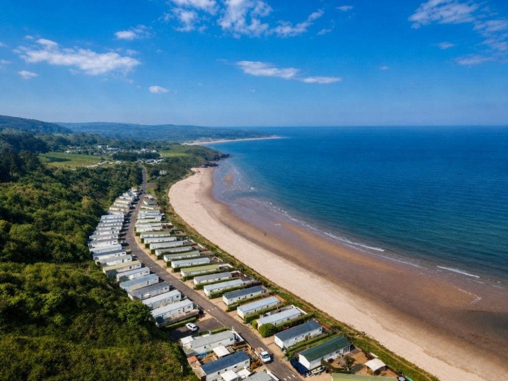
A mixed cove between Silver Strand and Brittas Bay offering both beach AND rock fishing, unusual on this coast. Wrasse and pollack patrol the rock platforms; bass, flounder and the occasional pollack take baits and lures over the sand patches. Regional sources also note occasional school bass outside the April to November season window; treat winter reports as local colour, not the main season. Autumn night fishing is the documented best window. Direct road access has been closed off due to holiday-home development; coastal walk-in or caravan-park entry is required.

In season here this month

All the species recorded here: Bass, Wrasse, Pollack, Flounder, Whiting, Coalfish, Mackerel, Dogfish, Conger eel, Garfish, Sea trout.

The law for its species

  • Bass: Retention allowed. At most two bass per 24 hours; the rest go back. Minimum size 42 cm for any bass kept. Rules checked 29 June 2026.
  • Pollack: Retention allowed. At most three pollack per 24 hours from 1 June 2026, then catch and release. Pollack under 30 cm go back as good practice, not by law: that EU minimum is set for commercial fishing, not for shore anglers. Rules checked 30 September 2026.
How it is fished

The tide. Two hours either side of high water gives best access to the rock ledges and puts fish in range. At low water the ground is very rough and snaggy on the rock side. The flooding tide is best for wrasse and bass, fish the colour change where reef meets clean sand. Crab particularly good in autumn.

Methods. Float rig (wrasse); Running ledger over sand patches; Texas-rigged soft plastics; Jig fishing (pollack).

Baits. Ragworm; Peeler crab (autumn, particularly effective); Sandeel; Mackerel strip.

Local knowledge. School bass appear in numbers in winter here, which the Eastern Regional Fisheries Board guide documents and most season charts miss. Both beach and rock fishing produce, and most anglers commit to one or the other and miss half the productive ground. The rock platform on the right (south) side is for wrasse, pollack and bass on lures over the colour change; the sand patches are for bass and flounder on bait. Access has materially changed in the past decade, the road approach in older guides is no longer accurate due to holiday-home development; route via McDaniels pub caravan park (swipe barrier) or coastal approach from Silver Strand/Brittas Bay. Autumn night fishing is the documented prime window across SAI threads. The combination of rock + sand pockets + autumn night bias mirrors several Cornish bass marks tactically: lures over the colour change at dawn/dusk, bait into sand pockets after dark.

From the mark’s guide, not checked on site.
Getting there

Access. Direct road access has been closed off due to holiday-home development. Two access routes: opposite McDaniels pub via the caravan park (swipe-barrier access), or from the Wicklow side past the disused hotel and holiday homes (private property signage). Walk-in or coastal approach from Silver Strand or Brittas Bay is the alternative. Take the coastal road south from Wicklow town. Sturdy boots with ankle support essential. Not suitable for children or inexperienced anglers.

Parking. Parking at Jack's Hole is very limited with only a handful of spaces available near the access points. Arrive early especially at weekends as spaces fill quickly. If the small car park is full there are very few alternatives nearby so plan accordingly.

Nearest tackle. Wicklow town tackle shops, approximately 5 to 8km north. Stock up before leaving town.

Questions about Jack's Hole
What fish can you catch at Jack's Hole?
Jack's Hole produces Bass, Wrasse, Pollack, Flounder and Whiting. Which of those are actually feeding depends on the month: the season grid on this page shows the peak and catchable months for every species listed here.
What bait works at Jack's Hole?
Ragworm, Peeler crab (autumn, particularly effective), Sandeel and Mackerel strip are the baits that work at Jack's Hole, fished on float rig (wrasse), running ledger over sand patches and texas-rigged soft plastics.
Where do you park for Jack's Hole?
Parking at Jack's Hole is very limited with only a handful of spaces available near the access points. Arrive early especially at weekends as spaces fill quickly. If the small car park is full there are very few alternatives nearby so plan accordingly.
How do you get to Jack's Hole?
Direct road access has been closed off due to holiday-home development. Two access routes: opposite McDaniels pub via the caravan park (swipe-barrier access), or from the Wicklow side past the disused hotel and holiday homes (private property signage). Walk-in or coastal approach from Silver Strand or Brittas Bay is the alternative. Take the coastal road south from Wicklow town. Sturdy boots with ankle support essential. Not suitable for children or inexperienced anglers.
What are the hazards at Jack's Hole?
Slippery rock ledge with south-easterly swell wash. Non-slip footwear is essential. Check sea state before descending, budget for snag losses on the rock side, and never fish this mark alone.
Do I need a licence to fish at Jack's Hole, and what can I keep?
No State rod licence for ordinary sea angling. Salmon and sea trout need one. Retention rules do apply to some species here. Bass: retention allowed, 42 cm and pollack: retention allowed, no statutory minimum. Check the linked authority before keeping a fish.